
What did you want to be when you grew-up? Does it resemble your current career path? If so, it may have been written in the...
Tags: Constituent Engagement, GIS Map, Government Efficiency, Blog

Time travel. Flying cars. 2018 may not have brought us all of the innovations science fiction writers predicted it would, but...
Tags: GIS Map, Government Efficiency, Blog

Have you heard? For the first time since 1979, the new moon’s passing across the sun will be visible—or at least, noticeable—as...
Tags: GIS Map, News, Customer Success

Upon entering South Orange, New Jersey, you are greeted by a sign that reads, “Welcome to the Village of South Orange, Settled in...
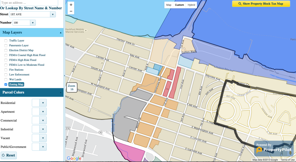
GovPilot™ is extremely proud of our namesake software’s geographic information system (GIS) mapping capabilities and we have...
Tags: GIS Map
Across the globe, local governments are using geographic information systems (GIS) to engage citizens, deliver improved services,...
Tags: GIS Map, Government Efficiency