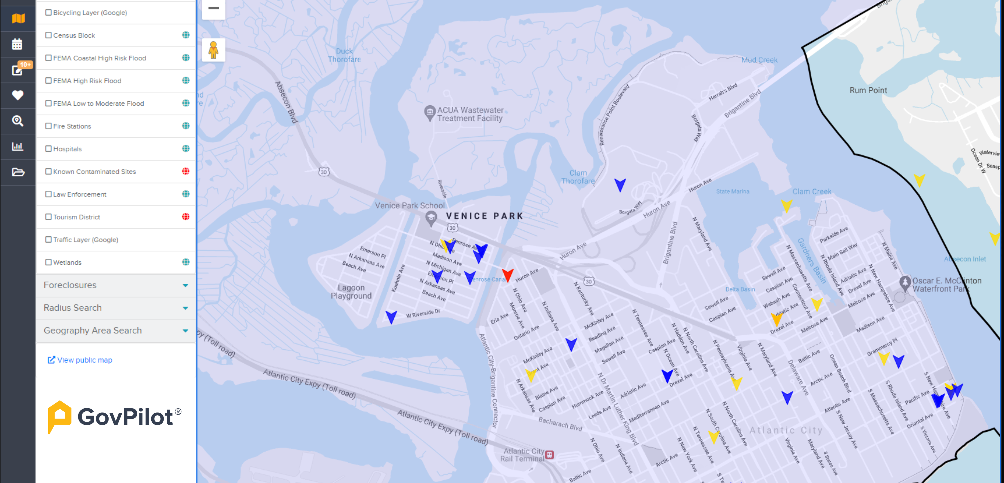
Flood insurance premiums are rising nationwide as FEMA's Risk Rating 2.0 seeks to tie costs to property-level risk. Communities that proactively manage flood risk can lower those premiums for residents through the Community Rating System program (CRS). More important, following best practices means making flood-prone communities more resilient. GIS mapping is one of the most powerful tools to get there.
With coastal flooding trends increasing according to NOAA, the urgency of flood mitigation has never been greater—and communities are responding. States with the highest coastal vulnerability are leading CRS participation, demonstrating the program's proven value in protecting residents:
- Florida
- New Jersey
- California
- North Carolina
- Illinois
Moreover, participation by communities in all 50 US states demonstrates that local governments have real ways to help constituents make communities safer. Today's GIS-based government management software can help, especially in smaller municipalities with limited staff.
Five Proven Strategies that GIS Technology Makes More Achievable
- Join FEMA's Community Rating System
Think of the Community Rating System as FEMA's way of saying "well done" to communities that go beyond the bare minimum in flood mitigation. When you do more than what's required for floodplain management, your residents can realize real discounts on flood insurance and recover faster when floods happen.
How GIS makes this easier:
- You can map and track everything that earns you credit: stormwater projects, preserved open space, infrastructure upgrades
- Built-in documentation tools mean regulatory reporting doesn't turn into a scramble every recertification cycle
- Dashboards let you see your progress in real time and share wins with your state and your community
Real-world example: A township that uses GIS to inventory and map all storm drains and wetlands is building concrete proof of quantifiable flood risk reduction. That documentation can bump the community to a higher CRS rating, which means lower premiums and more flood resilience for everyone.
- Get Buildings and Utilities Above the Flood Line
Homes and facilities built or elevated above the Base Flood Elevation (BFE) face less risk. Less risk means lower insurance costs:
- Pull together parcel data and elevation data to spot which structures are most vulnerable
- Track building permits for elevation projects or retrofits
- Keep digital records of compliance that don’t require digging through file cabinets
- Fix Drainage Before It Becomes Everyone's Problem
A lot of flooding doesn't start with a river overflowing. Instead, it starts with stormwater systems that are clogged, undersized, or just plain broken.
GIS can make this easier by:
- Maintaining an interactive map of every drain, pipe, and retention basin in your system
- Helping teams set up maintenance and inspection schedules
- Layering in rainfall and soil data to plan smarter upgrades
When you have a digital map of your stormwater assets, you're being proactive about flood mitigation.
- Help Property Owners Floodproof Their Buildings
Flood barriers, backflow preventers, flood-resistant materials minimize damage during floods and can help slow down future rate increases.
A GIS-based management platform can help local governments:
- Log and track mitigation grants, inspections, and retrofit projects all in one place
- Map properties with repetitive flood losses so teams can prioritize outreach
- Use mobile apps to capture field data and keep your records current without the paper shuffle
- Keep Your Flood Maps Up to Date
Existing flood maps may overstate risk. Maybe your community invested in better drainage. Maybe the topography was re-surveyed. If you can prove conditions have improved, you can request reclassification, and that means lower premiums. GIS makes this easier by:
- Storing and visualizing the latest elevation data, LiDAR scans, and survey results
- Tracking projects that change drainage and hydrology
- Helping you submit accurate, organized data for map amendments or updates
Pulling It All Together
Managing floodplain data, tracking CRS credits, and keeping up with compliance paperwork can be challenging . But it doesn't have to feel impossible.
A GIS-based management platform like GovPilot can:
- Centralize all your floodplain maps, permits, and inspection records in one place
- Automate compliance reporting, making it fast and accurate
- Track infrastructure and mitigation projects across departments
- Give you visual dashboards that show progress at a glance
When all your teams are working from the same system, compliance and emergency management are easier.
That’s why lowering flood insurance rates isn't just about saving money, though that matters. It's about protecting your residents and giving your community a fighting chance when the next storm hits.
In other words, smart data management is smart risk management. And it pays off in communities that are safer, stronger, and built to last.


